We provide strategic advisory and visualization of your property using maps and official data, highlighting any restrictions or opportunities that may affect its value or potential use.
This service is designed for property owners who wish to sell, evaluate, or inform prospective buyers.
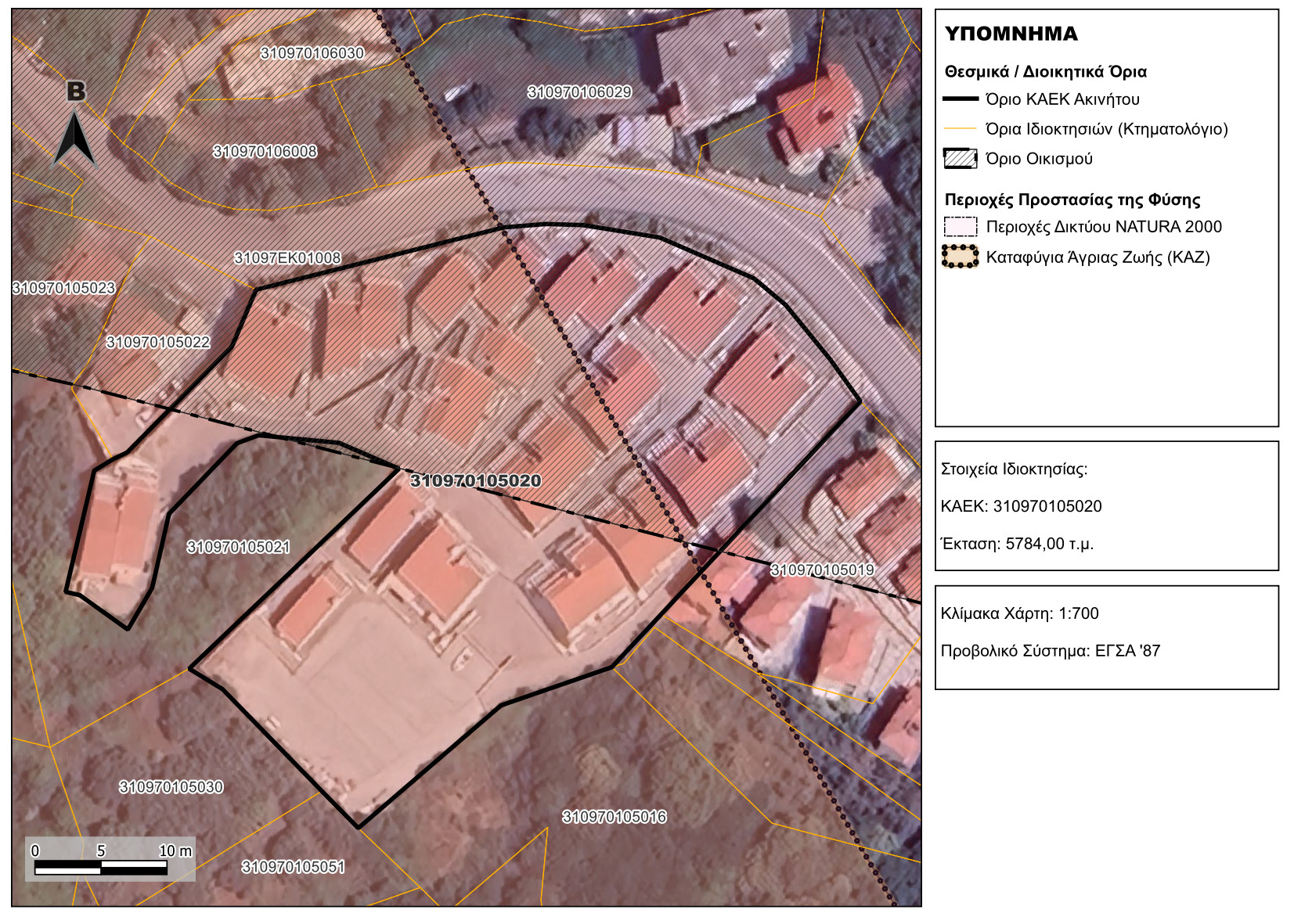
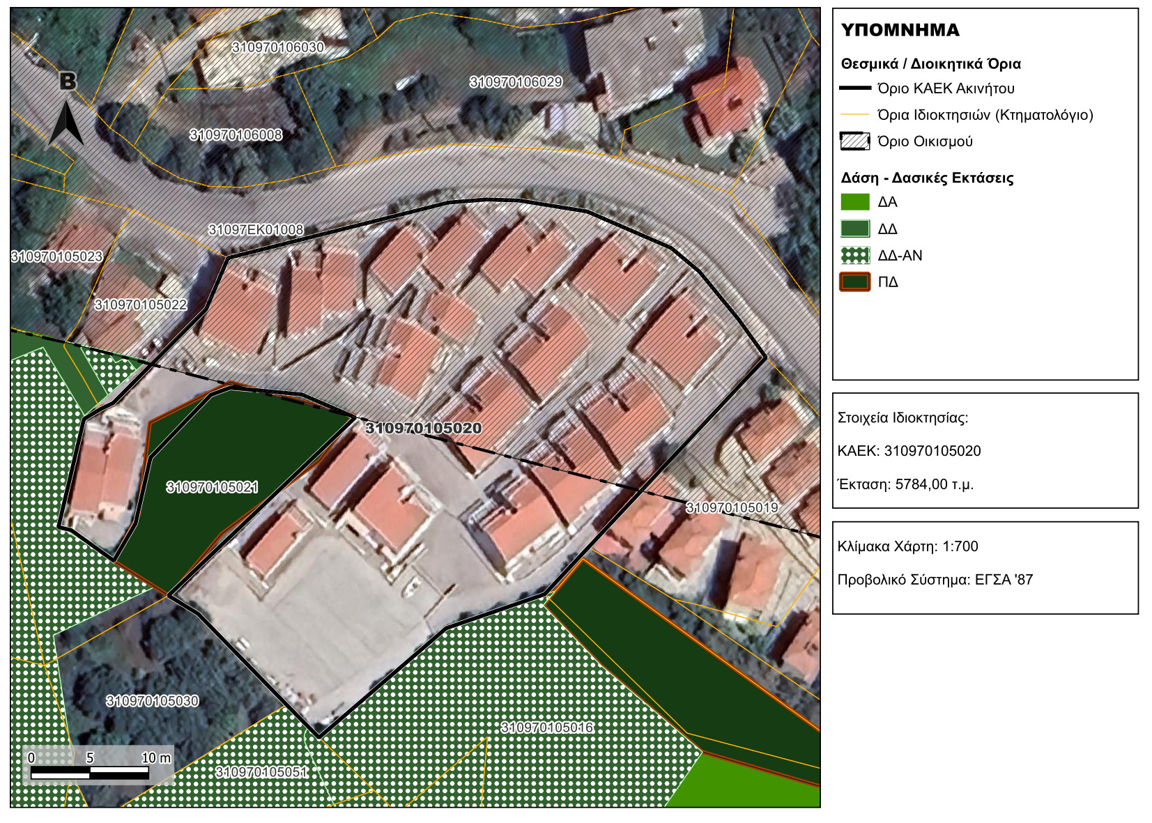
Detailed mapping of a property’s location in relation to settlement boundaries and protected environmental zones.
Clear overview of whether the property falls within settlement limits, forest land, or agricultural zones, affecting building rights.
Key Elements We Visualize
Cadastral Data
Display property boundaries and associated cadastral codes.
Identification of neighboring parcels and their cadastral reference numbers.
Natura 2000 Sites / Protected Areas
Forest Designations / Forest Maps
Public Environmental Designations
Scenic forests, wildlife refuges, and other environmentally protected areas.
Administrative and Legal Boundaries
Additional Elements
Archaeological and Historical Sites
Special zoning or land-use restrictions
Public environmental and technical infrastructure
We do not issue licensed engineer endorsements, but we deliver in-depth analysis and clear visualization of the official data.